What is Wrack?
Wrack is flotsam — seaweed, seagrass, shells, small sticks and other natural materials — deposited by receding tides. For COASST it can also mark the top of the surf zone.
Stormy weather can create an especially dense wrack line because wave action dislodges more seaweed and deposits the free fronds high on the beach. But storms can also wipe a beach entirely clean! That variability is exactly why we ask about the wrack zone on each beach survey.
Let’s look at a few examples of the wide variety in wrack zones on real COASST beaches.
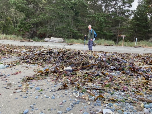
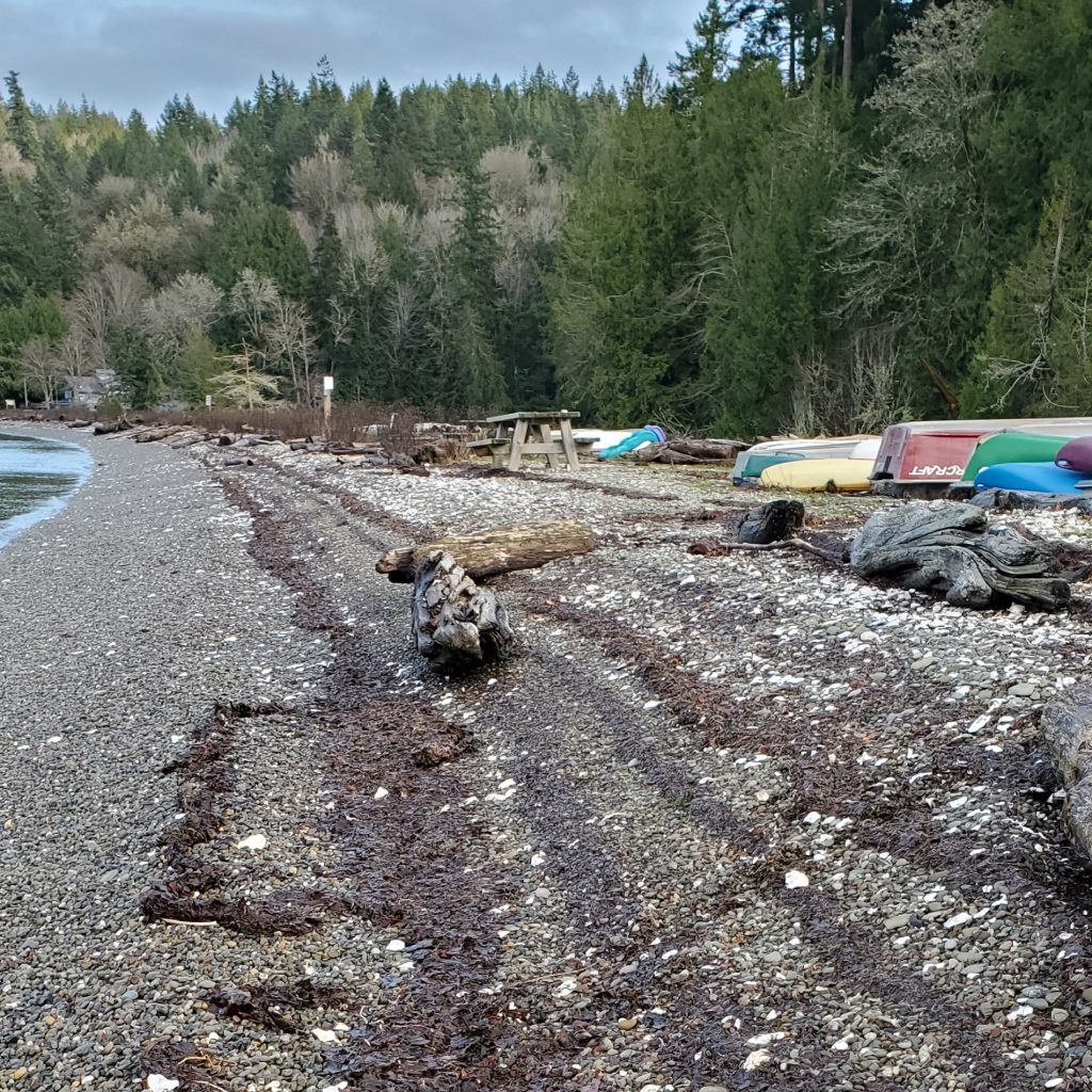
On the left photo below (from Christine Clark’s survey of Foulweather Bluff in November 2020) we see an example of multiple wrack lines where the highest consists of small sticks. The wrack is continuous along the entire length of the beach, and the wrack lines only cover about 50% of the wrack zone.


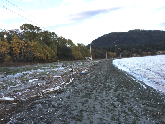
The right photo above (by Jack Marshall, November 2020) is a nice contrasting example of a dense, continuous wrack line that covers 100% of the wrack zone on Hollywood Beach. In this photo we can see that this beach has no surf zone below the thick line of wrack!
Continuous or Patchy?
The COASST cover sheet asks if the wrack is continuous or patchy across the whole length of the beach. Lines of wrack are considered continuous while scattered flotsam is patchy.
A fun way to describe this difference is to imagine playing the ‘hot lava’ game. (Perhaps you’ve done this with small children?) In this game, there is only one rule – the floor is lava, and you can avoid the ‘lava monster’ by leaping between objects to avoid stepping on the ground!
If you can walk the length of your beach without touching the sand or cobble ‘floor’ then this is continuous wrack. If you have to ‘leap’ to connect the dots of wrack then it’s patchy. There can be multiple wrack lines and only one needs to be considered continuous to make it from one end of the beach to the other.
Continuous wrack, with ~100% coverage (a single line of wrack):
Continuous wrack, with ~50% coverage made up of sticks and seaweed:
Patchy wrack, <25% coverage:

Wrack Lines vs Wrack ZONE?
A line of wrack
Another line of wrack
And yet another
Do these separate lines of wrack count as all one zone?
Yes! The wrack zone includes the whole area where flotsam was deposited – not just the thin lines. If consecutive high tides get lower each time, or if the tide goes out gradually, then there will be multiple lines of wrack. The wrack ZONE is measured from the freshest line near the surf up to the highest, oldest line of wrack.
In the above photo of ZPPOA (January 2021) by Cherylann Schmitt we can see an example of multiple continuous lines of wrack, and ~75% wrack coverage.
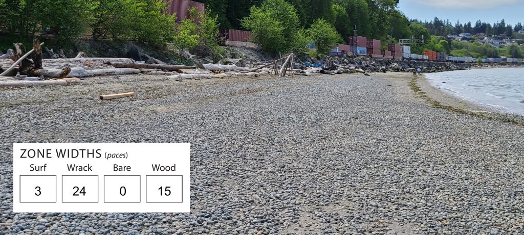
The photo below shows a beach with two continuous wrack lines that are VERY far apart – one at the water’s edge and the other up against the wood zone. That whole area, including the bare substrate between the lines, is the wrack zone. We would call this <25% coverage.
What is Percent Coverage?
This one is for Medium and Small debris surveyors only!
On the Mapping Your Survey page, percent coverage is a question for the wrack zone in each surveyed rectangle. Does the wrack zone in the sampling rectangle cover less than 25%, 26-50%, 51-75%, or more than 75% of the substrate in your rectangle’s wrack zone?
You can read about debris distribution in the Sizing Up Marine Debris blog post – small debris is found in the highest percentage in the wrack zone.
If you just can’t get enough, please enjoy a few final examples of wrack and the wrack zone. And let us know if you have any questions about your own beach!
The top line of wrack on Crescent Beach is made up of small sticks while the rest is algae. This is continuous wrack, ~75% coverage.
Example of a continuous wrack line, ~50% coverage.
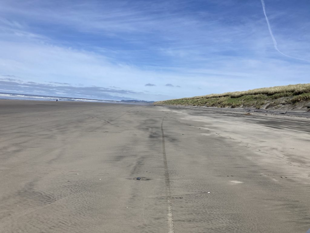
Example of no wrack.
Example of thin, continuous wrack, <25% coverage.
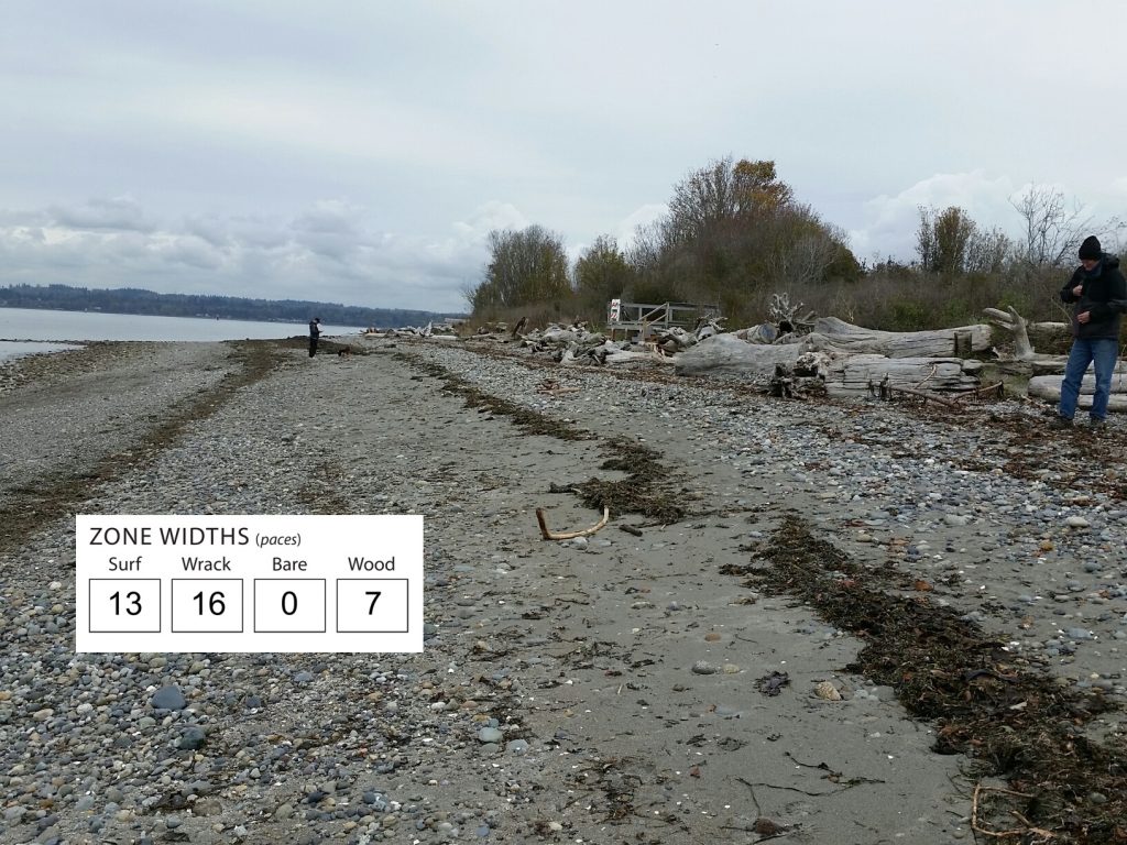
Example of three distinct, continuous wrack lines, <25% coverage. Below are the zone paces for Semiahoo Spit on this survey, where the wrack lines PLUS the bare substrate in between make up the wrack zone.