Since the first surveys began in 1999, COASST has steadily expanded from a nucleus of 5 beaches along the southern outer coast of Washington State to nearly 450 beaches spread across northern California, Oregon, Washington, and Alaska. From 12 stalwart participants who worked tirelessly to invent and refine the COASST system of carcass identification, COASST has grown to more than 1,000 participants, making us the largest beached bird network in the world.
Beached Birds
Dr. Julia Parrish founded COASST as a result of her long-time work on coastal seabirds of the North Pacific. Able to collect detailed annual data on seabirds breeding at a single Washington State colony, Julia wondered whether the patterns of seabird population fluctuation observed at her study site—Tatoosh Island—were the same, or different, from colonies all along the coast. But time, money, and personnel limitations prevented either university scientists or natural resource management agencies from collecting needed data.
Julia recognized the need for a seabird monitoring program that would generate baseline data to help assess patterns of seabird mortality due to natural and human-induced events across both time and space. Without baseline data, she reasoned, we would only be able to speculate about causes of population change among marine bird species found in our nearshore waters.
Julia realized that a monitoring program in which scientists collaborated with coastal residents could generate vital information about North Pacific seabirds; while simultaneously giving participants the opportunity to voice their local expertise, engage in university science, and become a part of the science team.
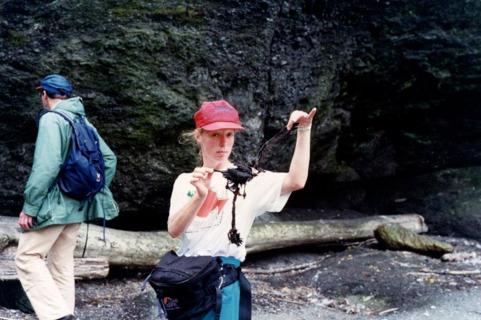
Given the increase of human use and impacts in the waters of coastal Washington where Julia worked, she envisioned the program providing data on both resident and migrant species; changes in mortality rates following oil spills; levels of chronic oiling; incidence of entanglement with fishing gear; and, possibly, cause of death. Instead of monitoring live birds—a difficult prospect for even the most dedicated scientists and birders—Julia decided that a far more tractable unit of information would be bird carcasses—in fact, beached birds. After all, beached birds were once alive, they died of something, they wash ashore regularly, and they can be identified by anyone.
In July of 1998, The David and Lucile Packard Foundation embraced Julia’s vision and awarded a grant to establish the program. Julia then hired Dr. Todd Hass. Within two years, Julia and Todd had brought COASST—the Coastal Observation and Seabird Survey Team – to life. Along the way, they designed an innovative guide—Beached Birds: A COASST Field Guide, invented a rigorous protocol, and established the first beach sites for monthly data collection. Within its first official data collection year, COASST had secured its longest lasting partner—the Olympic Coast National Marine Sanctuary.
COASST has steadily expanded from a nucleus of 5 beaches along the southern outer coast of Washington State to nearly 450 beaches spread across northern California, Oregon, Washington, and Alaska. From 12 stalwart participants who worked tirelessly with Todd and Julia to invent and refine the COASST system of carcass identification, COASST has grown to more than 1,000 participants, making us the largest beached bird network in the world!
And our participants are good! COASST Beached Birds boasts a stunning 85% of birds identified correctly to species over the 183 species found to date. We can prove that because each carcass identification is independently verified.
All of that high quality data has gone into revealing that there really is an underlying pattern for beached birds: the “right time, right place, right species.” You can see those patterns for each on the Explore Data page of this site. Now we know that although most years will be “normal,” occasionally there will be large, sometimes even huge, die-offs.
Marine Debris
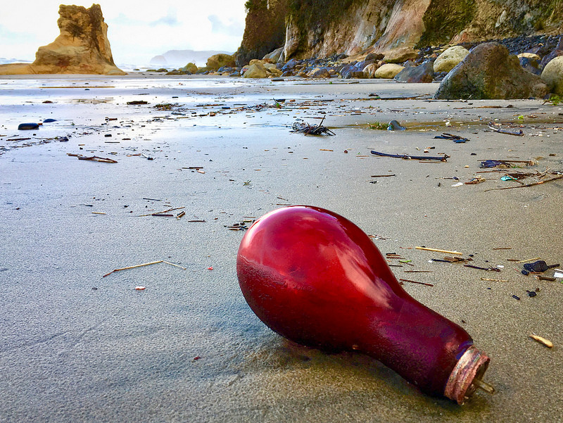
In 2014, COASST received a grant from the National Science Foundation to design and deliver our marine debris data module. What a challenge! Unlike beached birds, for which there are a finite number of choices (after all, there are only so many marine bird species), the list of marine debris items is endless (because humans are always inventing new things, and throwing them away). The COASST Marine Debris project doesn’t focus on identity, but instead on impact – what harm can this piece of trash do to wildlife and nearshore ecosystems – and sourcing – where did this item come from?
The COASST approach to marine debris centers on characteristics, from material (plastic? wood? rubber? ) to brand, language to size and color. We’ve also invented some COASST-unique characteristics like “floppy,” “loopy,” “sharp,” and “shiny.” No single piece of debris has all of the characters, but some debris are a combination of characters that spell harm, regardless of identity.
Floppy, translucent-to-white, non-degradable and neutrally-buoyant? Could be mistaken by a sea turtle as jellyfish prey. Floppy, loopy and non-degradable? A definite entanglement hazard for marine mammals. Large, open-sided container made of floating material? A potential death-trap for seabirds.
We learned a few lessons from our beached bird experience, and one was to involve participants early in co-development and (endless!) testing of a new protocol. Over 75 COASST pilot testers spent more than 200 of hours trying out protocol designs, inventing better ways to collect the information, and – most importantly – not stinting on detailed feedback! And while we’re still refining the COASST Marine Debris module 5 years later, we also have over 150 participants in our Washington and Oregon regions collecting vital information.
Data Uses
Having great data doesn’t mean anything if you don’t use it. In COASST, we “prove it and use it!” All COASST data are verified by experts. And that means that if you turn in the measurements, foot type and photo evidence for what you think is a Red-footed Booby, we can prove that you were right about this vanishingly rare tropical bird in North Pacific.
Our ability to prove the high quality of our data makes COASST data immediately useful to scientists and natural resource managers; and we’re in the business of sharing our data. In fact, COASST data are used for an amazing array of science and resource management projects, including:
Beached Birds:
- baseline monitoring for the introgression of avian influenza
- documenting the impacts of harmful algal blooms
- assessing the impacts of “The Blob” – the largest and most intense marine heatwave in the world
- modeling the likelihood that native Americans used naturally occurring mass mortality events as regular sources of food
- assessing bycatch events in the Salish Sea
Marine Debris:
- figuring out what beach types accumulate the most debris
- mapping the “harm” to wildlife through analysis of marine debris characteristics
Other Data:
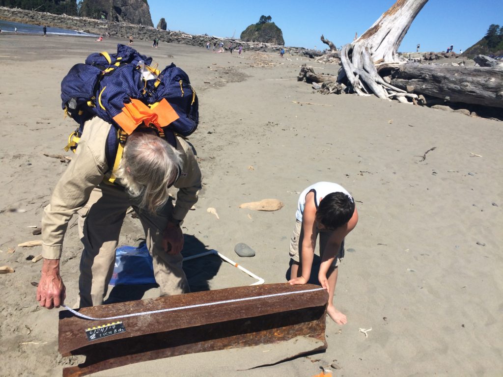
- measuring the background rate of marine mammal beaching
COASST Futures
We’ve been going since 1999, and we’re not done yet! With two well-researched data collection modules out there, we’re looking around for what to add next. Got a thought about how we should expand our efforts? We’re eager for your input.