Every COASSTer has questions about the zones on their beach at some point! This post is the first in our Zones FAQ series. If you’d like to test your skills at identifying beach zones, check out this link to our Zones Quiz.
What is a mudflat?
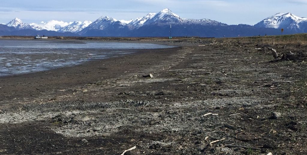
Mudflats refer to land exposed only during a very low tide – covered with silt, oyster reefs, and actively-growing algae. They are more common near estuaries than on outer coast beaches (though sometimes the tide goes WAY out there too!) and are more commonly exposed on an extreme tide. (Curious about the ‘how and why’ of tides? Check out this cook link that dives into the physics – it’s not just for kids!)
What are the benefits of mudflats?
Soft, smelly mudflats can act as a nursery for bottom fish and mollusks when the tide is in, as well as a resting and feeding area for marine and migrating birds when the tide is out. Many beaches near mudflat areas are protected by local or federal laws, which restrict nearby building projects in order to protect this habitat and vulnerable wildlife.
When the tide is low, how do COASSTers measure the ‘new’ zones?
Short Answer: we don’t!
COASSTers are asked to measured the beach to the the best of their ability, with safety as a top priority. And we only ask COASSTers to measure the searchable area.
If a low tide extends the surf zone out hundreds of meters – which are covered in sticky mud, seawater pools, or slippery algae…danger! – we would mark the walkable area in zone paces box and leave a comment that the mudflat extended beyond. If there is no walkable area that isn’t a mudflat, then that’s a ‘UM’ (unmeasurable) for the whole surf zone.
What would we say for this picture of Point No Point?
Is there a measurable Surf Zone? Where does the mudflat start?
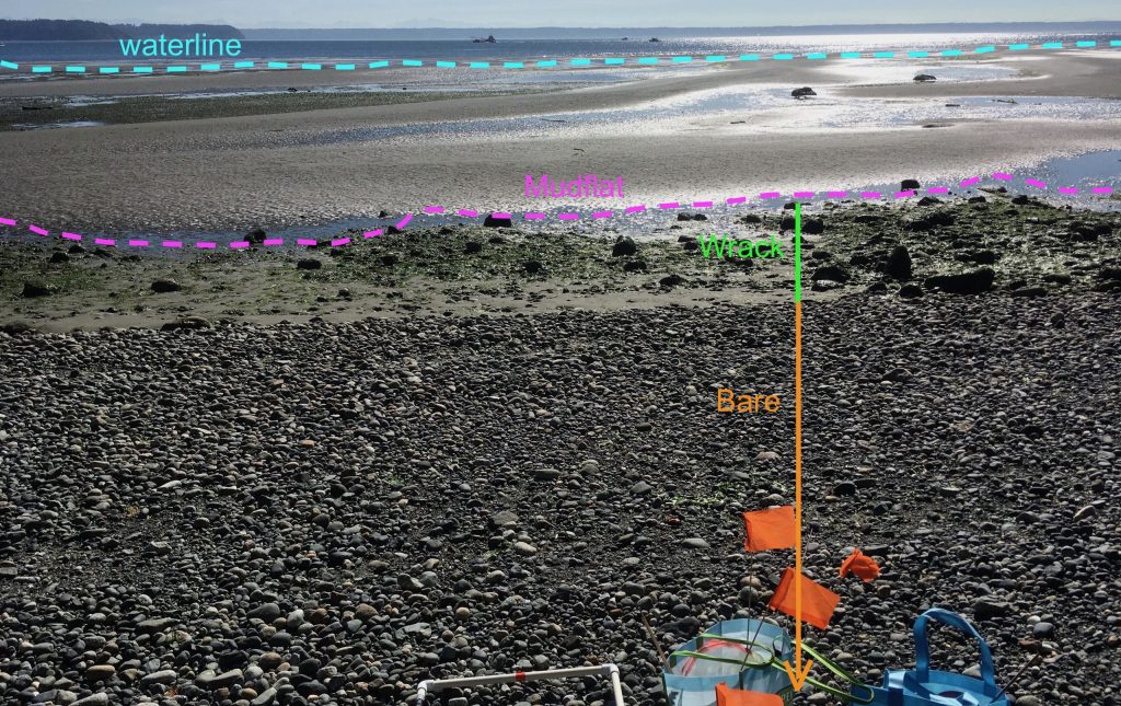
At the point where this photo was taken we cannot see a walkable surf zone – right along the bottom of the wrack line there is a small finger of water left behind from the receding tide. Rather than wading through these watery ‘intrusions’ as we march out in search of the receding tide, we can draw the line for the bottom of our survey where the first seawater intrusion falls.
Eglon Beach also has an interesting low tide!
What do you think about where we drew the lines for this beach?
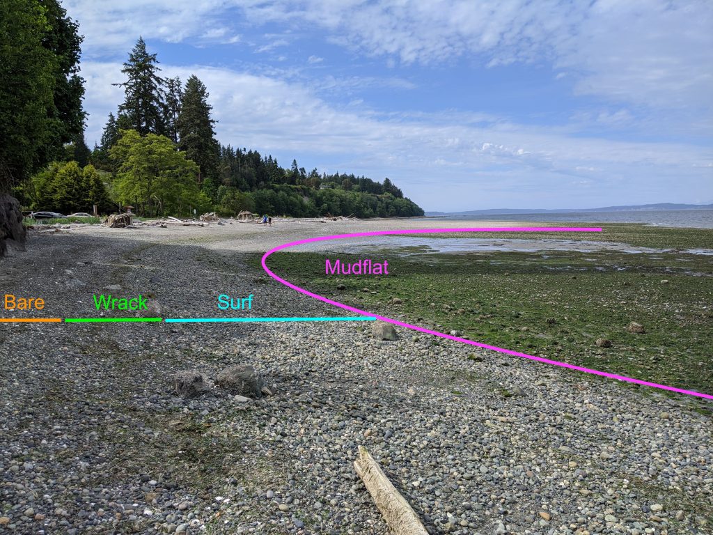
Notice how there is a small surf zone above the algae here – we would mark a small number of paces on the data sheet and leave a comment that there was a large mudflat that expanded beyond what we could measure.
This is a great example of living eelgrass at the edge of the beach! It is certainly not the most forgiving substrate to walk on because it is very slippery.
Fun Facts:
- Eelgrass plays a large role in nearshore ecosystems, providing food, oxygen, shelter, and a nursery habitat for young fish and birds.
- The grass anchors seafloor substrate and prevents erosion.
- Eelgrass is an indicator of estuary health because of its quick response to environmental changes such as changes in water quality. If the eelgrass fluctuates then the species that depend on it for food and safety are at risk.
- Learn more! https://www.dnr.wa.gov/programs-and-services/aquatics/aquatic-science/nearshore-habitat-eelgrass-monitoring
What’s going on at Millers Landing?
Below we can see that there is a large deposit of wrack that has been exposed to the cold – it’s tinged with frost! The surf zone (where our survey team is standing) is where the frost has been rinsed away by a recent, receding tide. The mudflat extends beyond.
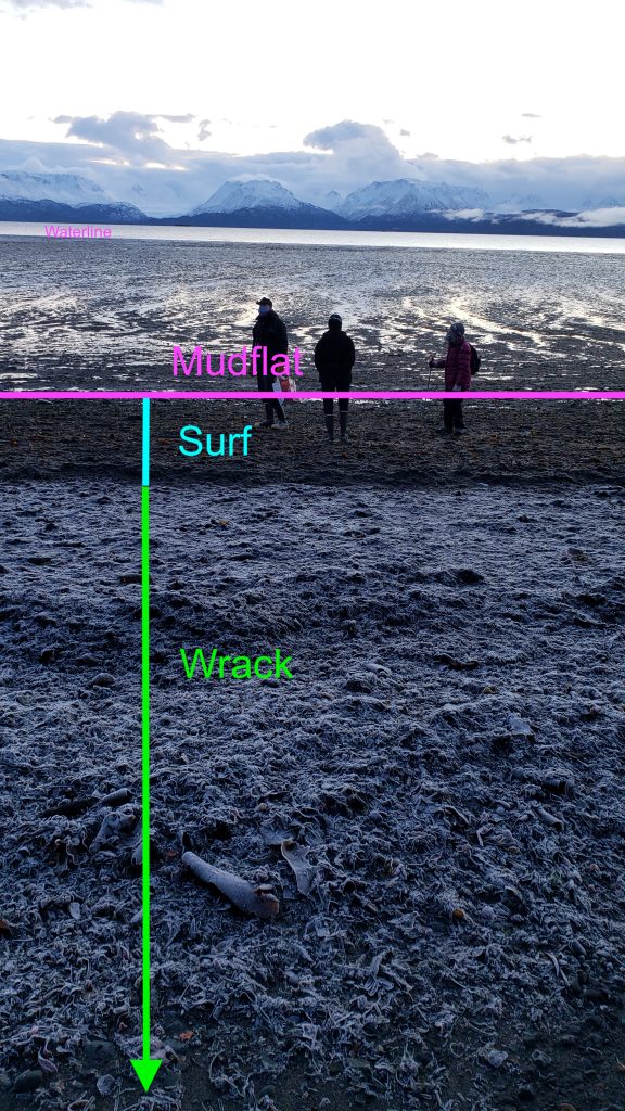
Here we draw the ‘line’ for the bottom of the surf zone where the muddy texture begins. With a view like this one, we certainly won’t forget to mention the impressive mudflat in the comments!